GR®532 : étape 4 de l'Etang de Hanau à Lichtenberg
Philippsbourg Medium
 Club Vosgien
 GR®
GR®
4. GR®532 : étape 4 de l'Etang de Hanau à Lichtenberg
4h36
13,9km
+554m
-455m
Crossing
Embed this item to access it offline
5 points of interest
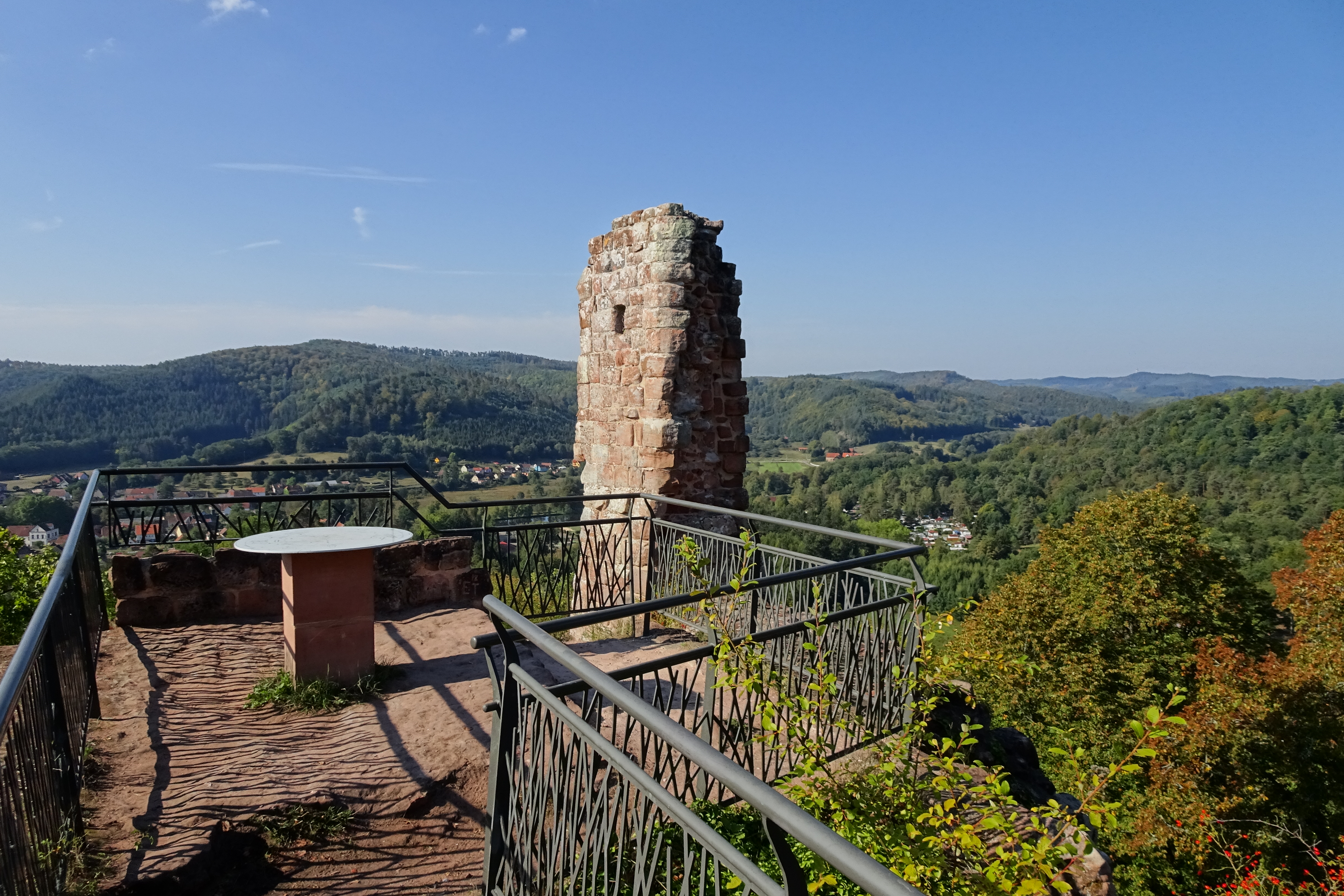
Château-fort de Rothenbourg - SYCOPARC  Castle-church-abbey
Rothenburg Chateau
The castle dates back to the 9th century. It was part of the County of Bitche in 1353 before becoming a den for knight-robbers, which earned him to be ravaged by the Strasbourg militia. It is in ruins since the 16th century. In 1938, he was integrated into the passive defense system of the Maginot Line and was occupied by the troops until 1940, but did not know the fight.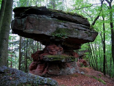
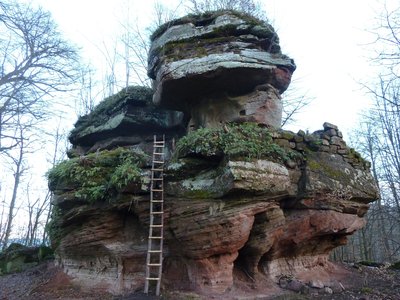
Guy Schnell - http://www.randoalsacevosges.com  Geology
Rocher de l'Abrahamfels
Rock of the Abrahamfels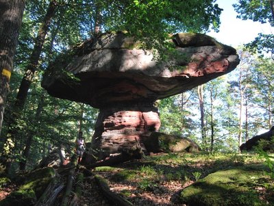
Guy Schnell - http://www.randoalsacevosges.com GeologyRocher du Pilsfels
Rock Pilsfels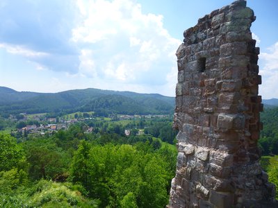
Point de vue sur la vallée et Baerenthal, depuis la plate-forme - PNRVN - A.Serylo Castle-church-abbeyRamstein fortified Chateau
Built at the end of the 13th century by the Lords of Winstein, Ramstein Castle was intended to control or prohibit access to the Zinsel Valley. But during the 14th century, the lords of Ramstein transformed their castle into a veritable den of brigands, pillaging and ransoming the entire region. Faced with this situation, the people of Strasbourg, with the help of their Bernese allies, organized a punitive expedition against the fortress and destroyed it in 1335.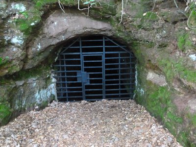
Une des entrées du souterrain, close par une grille spéciale "chauve-souris" - PNRVN - A.Serylo  Wildlife
Ramstein Underground Passage
These former military undergrounds served as a shelter for the inhabitants of Baerenthal during the fighting of the winter of 1944-45. Consisting of two parallel galleries connected by four shorter galleries, their entries have been closed since 1990 by special "bat" grids. Indeed, the temperature and the humidity during the winter are favorable to the hibernation of these animals. 11 different species were observed there.
Forecast
Altimetric profile
Sensitive areas
Along your trek, you will go through sensitive areas related to the presence of a specific species or environment. In these areas, an appropriate behaviour allows to contribute to their preservation. For detailed information, specific forms are accessible for each area.
- Impacted practices:
- Aerial, Aquatic, , Underground, Land, Vertical
- Sensitivity periods:
- JanFebMarAprMayJunJulAugSepOctNovDec
- Contact:
Email : contact@parc-vosges-nord.fr Tél. : 03 88 01 49 59
- Impacted practices:
- Aerial, , Land, Vertical
- Sensitivity periods:
- JanFebMarAprMayJunJulAugSepOctNovDec
- Contact:
Email : contact@parc-vosges-nord.fr Tél. : 03 88 01 49 59
- Impacted practices:
- Aerial, Aquatic, , Underground, Land, Vertical
- Sensitivity periods:
- JanFebMarAprMayJunJulAugSepOctNovDec
- Contact:
Email : contact@parc-vosges-nord.fr Tél. : 03 88 01 49 59
- Impacted practices:
- Aerial, Aquatic, , Underground, Land, Vertical
- Sensitivity periods:
- JanFebMarAprMayJunJulAugSepOctNovDec
- Contact:
Email : contact@parc-vosges-nord.fr Tél. : 03 88 01 49 59
- Impacted practices:
- Aerial, Aquatic, , Underground, Land, Vertical
- Contact:
Email : contact@parc-vosges-nord.fr Tél. : 03 88 01 49 59
Information desks

Tourist Office of Hanau - La Petite Pierre
2A rue du Château, 67290 La Petite-Pierre
Report a problem or an error
If you have found an error on this page or if you have noticed any problems during your hike, please report them to us here: